

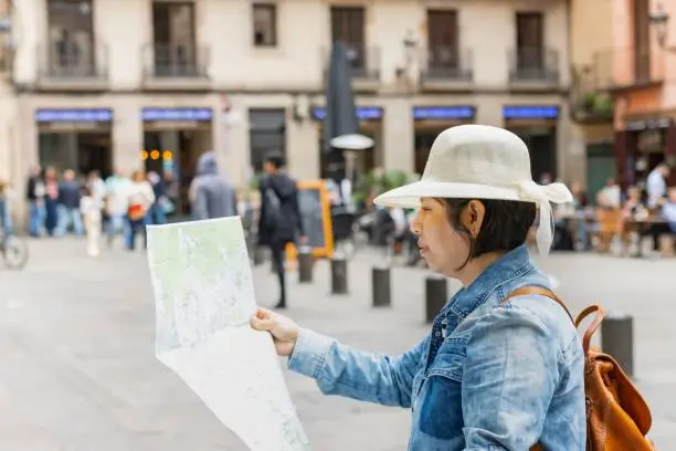
Barcelona stands as one of Europe’s most captivating metropolitan destinations, functioning as a true treasure chest of architectural marvels, historical quarters, and vibrant cultural centers. To navigate this vast urban expanse effectively, first-time visitors and seasoned travelers alike benefit greatly from using a detailed guidebook. Beyond simply assisting you in reaching a physical destination, a map of Barcelona helps unlock the city’s complex history, stunning art installations, and authentic local life.
Decoding the Dual Architecture of Cerdà’s Grid and Medieval Alleys
How do Barcelona’s contrasting urban planning epochs shape the experience of reading a city map?
The physical layout of Barcelona presents a striking visual juxtaposition between ancient medieval fortifications and visionary 19th-century master planning. The oldest section, known as Ciutat Vella, evolved organically over centuries into a dense labyrinth of narrow walkways, hidden courtyards, and ancient plazas. In stark contrast, the surrounding Eixample district reflects the meticulous engineering of Ildefons Cerdà, who designed an orderly geometric grid featuring wide thoroughfares and signature chamfered street corners.
When studying a map of Barcelona, recognizing this structural shift helps travelers orient themselves instantly. The organic winding paths of the Gothic Quarter require frequent compass checks and landmark spotting, whereas the mathematical square blocks of Eixample allow visitors to navigate effortlessly from one iconic modernist masterpiece to the next without losing their bearings.
Locating Essential Neighborhoods Across the Metropolitan Area
Which primary districts define the character of Barcelona when plotted on a geographic guide?
Plotting your daily itinerary becomes significantly simpler once you divide the metropolis into its distinct geographic zones. The urban landscape flows outward from the ancient harbor front through several specialized neighborhoods, each offering unique architectural styles and local attractions:
The Gothic Quarter: Nestled within Ciutat Vella, this historic center features medieval stone facades and the towering Barcelona Cathedral, acting as the spiritual heart of the old city.
The Eixample District: Stretching north from Plaça de Catalunya, this expansion zone houses the celebrated works of Antoni Gaudí, including the towering basilica and ornate residential apartments.
La Rambla Corridor: Serving as the famous pedestrian artery dividing the old quarters, this tree-lined promenade connects central public squares directly to the modern port.
Montjuïc Hill: Rising dramatically above the southwestern coastline, this elevated green space holds major cultural institutions, botanical gardens, and historic fortifications.
La Barceloneta: Positioned right along the Mediterranean shoreline, this traditional maritime neighborhood provides immediate access to sandy beaches and seafood dining.
Integrating Transit Diagrams with Geographic Wayfinding
How do municipal subway systems and regional train lines align with traditional tourist street maps?
Connecting spatial street maps with public transit diagrams ensures seamless travel across the sprawling metropolitan region. Official transport networks feature color-coded underground lines that intersect directly beneath major sightseeing zones, allowing visitors to bypass lengthy cross-town walks when energy runs low.
To illustrate how municipal transit links coordinate with regional geography, the table below outlines the primary rail corridors servicing central locations:
| Transit Line | Primary Color Route | Key Landmarks and Neighborhoods Served |
|---|---|---|
| Metro Line 1 | Red Line | Plaça de Catalunya commercial center and Gothic Quarter access points |
| Metro Line 3 | Green Line | La Rambla pedestrian corridor, Liceu theater, and Park Güell approaches |
| Metro Line 5 | Blue Line | Sagrada Família basilica and central Eixample avenues |
| Regional Rodalies | Various Suburban Colors | Coastal towns and outer metropolitan destinations beyond city limits |
Leveraging Digital Navigation and Offline Mobile Tools
What technological applications and offline backups provide the most reliable support for modern travelers?
Modern navigation relies heavily on smartphone applications like Google Maps and official municipal transit platforms for real-time route planning and schedule updates. These tools allow visitors to zoom into specific city blocks, check verified operating hours, and track walking directions instantly. Similar to travelers seeking international adventures such as exploring Croatia for first-time visitors, maintaining reliable digital preparedness prevents unexpected travel disruptions.
However, relying solely on cloud-connected devices can present challenges inside subterranean subway stations where cellular signals frequently drop. Downloading offline map packages or carrying a traditional paper backup guarantees continuous orientation regardless of battery levels or network availability.
Avoiding Common Navigation Pitfalls and Managing Accessibility
What practical precautions and accessibility guidelines help visitors navigate city streets safely and efficiently?
Successful urban exploration requires awareness of common navigational mistakes and pedestrian customs. Visitors frequently confuse similarly named thoroughfares, such as mistaking the grand Passeig de Gràcia for the sweeping Avinguda Diagonal, so verifying street signs against a detailed map prevents frustrating detours. Additionally, because the historic alleyways of Ciutat Vella attract heavy pedestrian traffic, remaining attentive to personal belongings in crowded zones is essential.
Barcelona is also exceptionally friendly to cyclists and pedestrians, featuring extensive dedicated bike lanes and large vehicle-free zones. Travelers with limited mobility should utilize accessibility map filters to identify step-free metro stations equipped with operational elevators and ramps.
Conclusion
Why is developing strong spatial awareness vital for an unforgettable experience in the Catalan capital?
Navigating Barcelona with a reliable map transforms a standard vacation into an immersive cultural journey through history, architecture, and daily local life. Whether you are deciphering medieval labyrinth paths, admiring modernist facades, or relaxing along the Mediterranean shoreline, proper orientation makes all the difference. Choose the navigation tools that best suit your travel style, keep your bearings clear, and enjoy every moment exploring this remarkable destination.
Frequently Asked Questions
Do I need a paper map or is a smartphone sufficient in Barcelona?
While smartphones with navigation apps are extremely convenient, keeping a folded paper map or downloading offline data is recommended as a backup for cellular dead zones.
How easy is it to walk between major attractions in Barcelona?
Central districts like the Gothic Quarter and Eixample are very pedestrian-friendly, but taking the metro is recommended when traveling between distant points like Montjuïc and Park Güell.
What is the easiest way to understand Barcelona’s street grid?
The Eixample district is laid out in a distinct grid system with chamfered corners designed by Ildefons Cerdà, making it much easier to navigate than older medieval neighborhoods.
Are Barcelona metro maps available in English?
Yes, all official metro stations, ticket machines, and digital transit apps offer multi-language options including English for easy route planning.
How can I find wheelchair-accessible routes on my map?
Official transit apps and accessibility map layers clearly highlight stations equipped with elevators, ramps, and step-free pathways across the rail and bus networks.
Where can I get a free paper tourist map of Barcelona?
Official tourist information offices located across the city center provide complimentary paper maps and transit guides to incoming visitors.
Disclaimer: Urban layouts, public transit schedules, and ticketing details in Barcelona are subject to change. Travelers should always verify final transit routes and operating hours through official municipal sources before embarking on their daily itineraries.


